Buckley Clay
Hello folks its Sunday
once again and I am writing the weekly blog it it was a bank holiday the blog is a day late. All is going well at the pottery I
have had a busy week building new stock. I have been doing a lot of hand
building, sculpture and mugs etc.
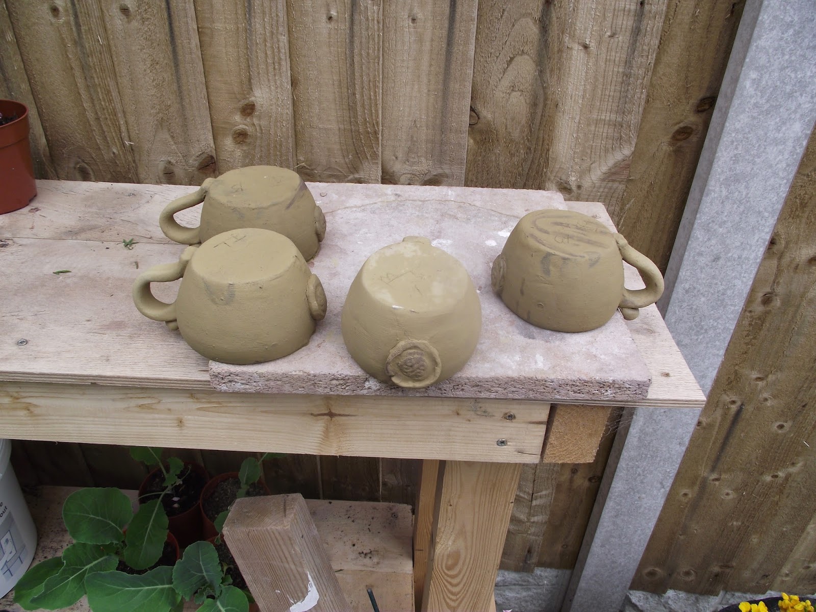
Pinch-pot mugs with Buckley clay

I have found this a great release to improve my skills away from the wheel although making stuff this way is a lot slower. I have gained a great deal of satisfaction from manipulating the clay and honing skills once again.
I am very pleased with
the last bisque firing, and some of the pots turned out very well. I was amazed
at the yellow Buckley clay turning a very orange terracotta colour. Buckley clay drying and the finished result


The area around Buckley in Flintshire,
north Wales, has been associated with the production of pottery for at least
600 years. To understand why Buckley developed as a potting centre, it is
necessary to examine its location. As with other major production areas, its
geological and geographical location was the prime reason why the pottery
industry developed.

Figure 1: North Wales and Merseyside
Buckley is situated 12km west of the city
of Chester and 4km north of Mold at a height of 140m above sea level on Buckley
Mountain, about 5km south of Connah's Quay, on the Dee Estuary (Fig. 1).
The solid geology of the region is
Carboniferous Limestone, which is overlain by Coal Measures (for local geology,
view the online British
Geological Survey map). The area around
Buckley is composed of Middle Coal Measures, the upper layers constituting the
Buckley Fireclay Group.
The Buckley Fireclay outcrops along the line of a major fault, the Great Fireclay Fault. Smaller faults in the coalfields gave rise to horst and graben structures. These are small uplifted fault-blocks separated by down-thrown segments. These exposed the clays and coal seams, which attracted the potters to Buckley. The faulting caused mineralisation to take place along the eastern Carboniferous outcrop on the limestone, producing lead sulphide (galena), the source of lead for glazing the pots. Buckley clay from Buckley Mountain
The Buckley Fireclay outcrops along the line of a major fault, the Great Fireclay Fault. Smaller faults in the coalfields gave rise to horst and graben structures. These are small uplifted fault-blocks separated by down-thrown segments. These exposed the clays and coal seams, which attracted the potters to Buckley. The faulting caused mineralisation to take place along the eastern Carboniferous outcrop on the limestone, producing lead sulphide (galena), the source of lead for glazing the pots. Buckley clay from Buckley Mountain

During the glacial period, boulder clay
was deposited from two sources. The Northern Drift comprises bands of buff loam
within red boulder clay. It is composed largely of Triassic material from the
bed of the Irish Sea, south Lancashire and the Wirral peninsula, and in the
north-east part of the district is identical in character with that of the
Wirral drift. The Welsh Drift
appears as a stiff yellow clay and where the Welsh and Northern Drifts meet
there is partial mingling The boulder clay of the Buckley region is generally
red. In the vicinity of Buckley Mountain there is a tough grey till which was a
basal deposit of the ice-sheet, and is composed almost entirely of Coal
Measures shales. This grey till may be the yellowish-brown clay found in a
weathered state on the Common at Buckley Mountain White clays were produced in
pockets in the Carboniferous Limestone in the pre-glacial period

Figure 2: Cross-section to show faulting (after Geological
Survey of Great Britain (England and Wales), Solid Sheet 108.
The raw materials were immediately
available. Transport was comparatively easy in that the pots were carted down
the hill to the Dee Estuary and then exported by water either to Chester market
or to ports around the Irish Sea.
This blog website is pretty cool! How was it made !
ReplyDeletelarge abstract wall art